LAND PLOT № 13

5,23 hectare

28000 $

For 1 ha

cadastral number  34:28:110023:2035
 

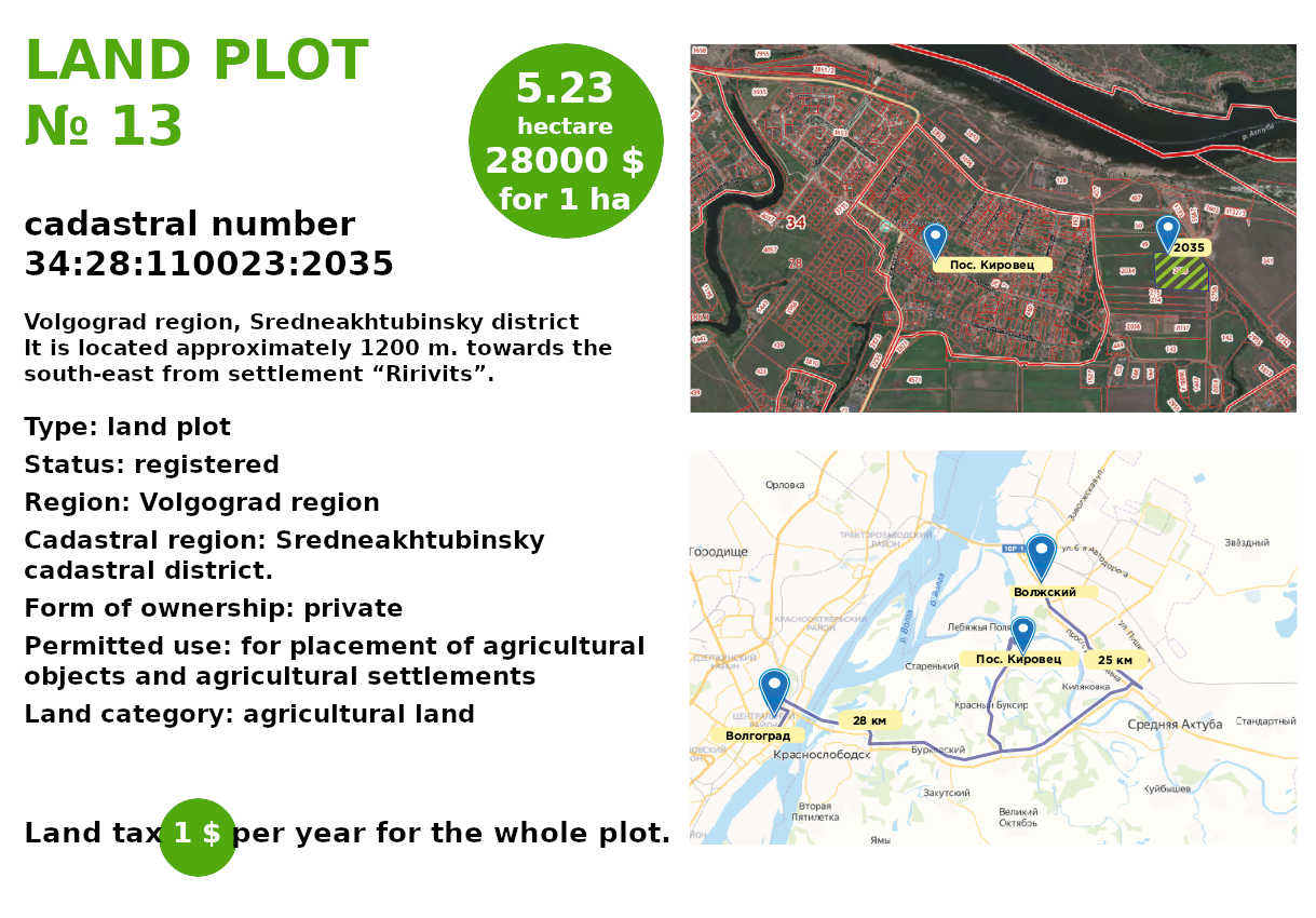
Volgograd region, Sredneakhtubinsky district

It is located approximately 1200 m. towards the south-east from settlement “Ririvits”.


Type: land plot

Status: registered

Region: Volgograd region

Cadastral region: Sredneakhtubinsky cadastral district.

Form of ownership: private

Permitted use: for placement of agricultural objects and agricultural settlements

Land category: agricultural land

Land tax 1 $ per year for the whole plot.

Prospective type of use:

For tourism organizing


In the lower reaches of the Volga river within the Volgograd region there are 4 natural areas that differ sharply from each other in landscape, composition of flora and fauna, structure of plant and animal communities, and ecological condition.

Volga-Akhtuba floodplain, an area on the territory of which there are settlements of different nationalities. You can meet more than 30 nationalities here. Tourism on the territory of the floodplain can be a profitable business project.